


Finding Healthy Food in Connecticut
Earlier this year, we invited fifteen fellows to develop their own web mapping applications, centered on equity and designed with communities in mind, using the SDOH & Place Toolkit. From July to September, we'll feature final fellow applications each week.
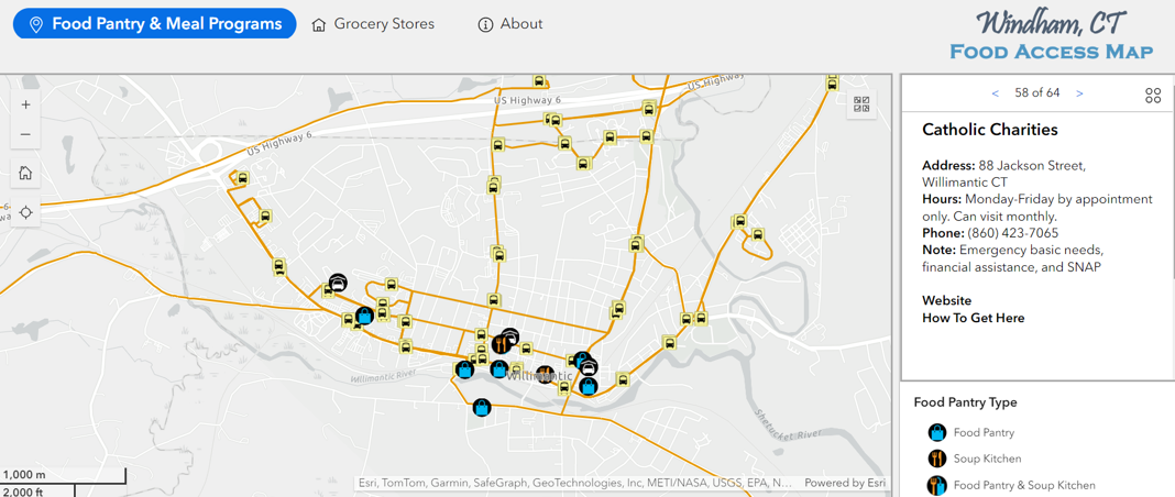
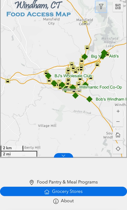
Windham & Willmantic, CT Food Access Map
By: Peter Chen, PhD, University of Connecticut
App Motivations
I created this app because I have always been intrigued by the idea of putting my GIS expertise into community practice, aiming to help those deprived of resources or experiencing health inequities to live healthy and sustainable lives. In the past few years, I have been doing fieldwork in Windham, CT (a low-income community in CT), to understand the various barriers to food access for low-income individuals, especially those utilizing a food pantry. This SDOH fellowship incentivized this project, allowing me to develop a GIS tool to promote information delivery and health education for these socially vulnerable populations.
This map is aimed at helping members of the Windham and Willimantic community, a low-income community in Connecticut, to maximize knowledge of local resources. Resources include grocery stores, physical activity, and public transportation. The goal is to decrease chronic disease risks by improving nutrition and physical activity through education.
Target users of this application include those that are low-income, those receiving federal assistance programs, or those utilizing food pantries.
Features
- Transportation-oriented design: All bus stops and routes are included, as some target users will take buses to access food. Additionally, each bus stop has a Google Street View showing its surroundings, helping users find the stop easily. Each food place has a link called 'How To Get Here,' which directs users to Google Maps for route information.
- Responsive app design: The app follows a responsive design, meaning it can be viewed on large, medium, and small screens with different layouts.
- Usability testing: We are testing the app's usability in a follow-up study using structured surveys and semi-structured interviews.
This project is completed and ready for all Windham and Willimantic community members to use.
Acknowledgements
The project is also sponsored by a USDA National Institute of Food and Agriculture grant (PI: Ock Chun).
If you are a community member of Windham and/or Willimantic, Connecticut, or would just like to check out Peter's work, you can access the application here.
Fellow Cohort: Spring 2024
Link to Web App: experience.arcgis.com/experience/8c7230430b6f4e92ab7c6353fe0e94a0
Tech Stack Used: Arcgis
About the Author
Dr. Xiang "Peter" Chen is an Assistant Professor in the Department of Geography at the University of Connecticut. Peter received his Ph.D. in Geography from The Ohio State University. His research interests are focused on Geographic Information Systems (GIS) and community health. He employs both a data-driven approach and a mixed-methods approach to unveil socioeconomic and health inequities resulting from the unequal distribution of health resources. His topical area is food access, evaluating whether community members can perceive and utilize healthy, affordable food provisioning from both place-based and people-based perspectives. This research theme is substantiated using GIS modeling, big data analytics, AI-based food image recognition, and community surveys.


